
Useful information for visitors to the Gloucester region:
timetables for trains & buses, brochures, maps, walks, scenic drives & more!
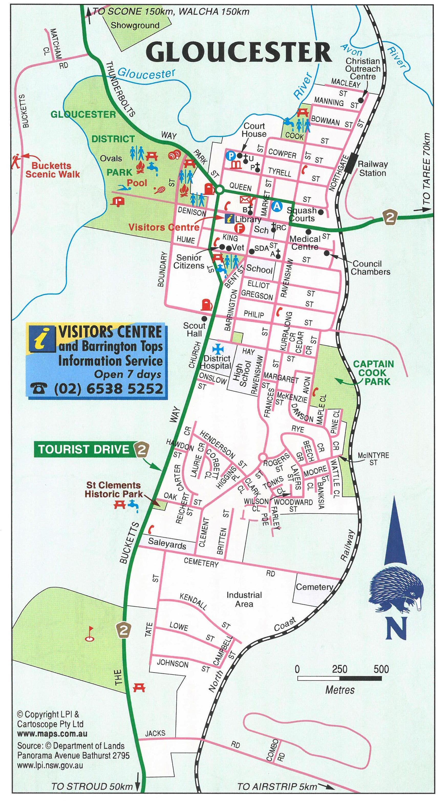
Map – Gloucester Town
Map – Gloucester regional map
Map – Copeland SCA map
Map – NSW NPWS Barrington Tops map
Map – The Bucketts Way map
Map – Bucketts Way wineries map
Map – Topdale Road map
Country Driving – Who to call if you breakdown
Driving in ice & snow – Helpful information
Timetables – Trains and buses
Scenic drives:
Buccan Buccans circuit – 34km return
Gloucester Tops – 115km return
Thunderbolts Way – Lookouts, forests, mountains, rivers
The Bucketts Way – 12 Mile Creek to Tinonee
4WD – Barrington Tops
Day trip from Gloucester – see the best of the rest of our region
Walks:
Buccan Buccan – scenic walk – Challenging – Be rewarded with spectacular views
Heritage walk – Easy – Gloucester Town
Mosaic walk – Easy – Gloucester Main Street
Things To Do:
Barrington Tops / Gloucester brochure
Bicycle – Gravel grinding & Mountain biking
Bird Watching
Camping
Camping with dogs
Caravaning
Fishing
Fossicking
Horse Riding
Paddling – Canoeing & Kayaking
Picnic Spots
Lookouts
Star gazing – Celestial calendar 2019
Swimming
Vineyards, Gin distillerys & Micro brewerys trail
Waterfalls & cascades
Tours:
Copeland Hidden Treasures Tours
